-40%
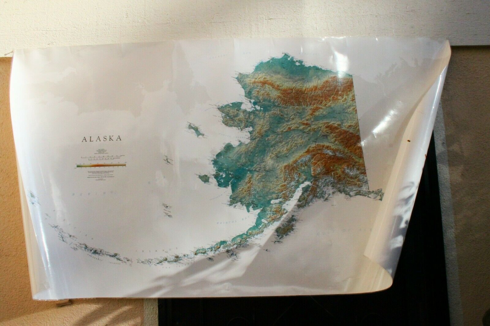
2003 ALASKA Raven Maps Topography LAMINATED Wall Map 64" x 36" - VERY NICE
$ 36.96
- Description
- Size Guide
Description
Thanks for visiting my Auction...---
UP FOR AUCTION
---
(1)
2003 2ND EDITION
RAVENS
TOPO MAP OF
ALASKA
1:2000,000 Scale
64" Tall x 36" Wide
RETAIL 0 + S/H
ITEM DETAILS
(SCROLL ALL THE WAY DOWN)
ALL YOU EVER NEEDED TO KNOW
ABOUT THIS ALASKAN MAP AND RAVEN MAPS.
I recently inherited my friends map collection.
I have no interest in keeping them, and decided to let them
go
to someone who will appreciate them more.
I 've also decided to let my photos describe their details/condition.
FYI
- I have similar maps currently up for auction,
and will combine shipping to save you more money.
CONDITION
In my opinion, I
would consider
this map to be in
excellent used/pre-owned
condition. It shows
absolutely
no signs of Abuse
and or Neglect. No stains, holes,
creases, and or rips/tears. It has never been exposed to the
sun, framed and or displayed.
All the maps in my collection are from
a non-smoking home, and
have been stored in the
same cardboard
tube that they were received in.
I have provided some detailed
photos
for your own personal evaluation.
Please review them carefully,
and you be the judge as to what condition you think it's in.
SHIPPING/HANDLING
BUYER PAYS only: .95.
Item will be shipped via
USPS-Mail
1 business day
after payment is confirmed
with eBay.
Returns are Accepted
up to 30 days
from date of purchase. Buyer pays return
shipping costs, and must
contact
seller first for a return address.
Combined shipping
available
.
THANKS AGAIN!
Best Regards,
Jason
Alaska, Physical, Laminated Wall Map by Raven Maps [no longer available]
Alaska has always been one of the two or three most popular maps here at Raven. Not only is it a spectacular landscape to visit, the state’s memorable outline and mountain arcs make a compelling graphic image.
But the state presents some real cartographic design challenges. It is huge, requiring a relatively small scale in order to fit on a sheet that is practical to display. And it is full of mostly very small
settlements and an infinite number of mountains and rivers and bays and capes, tricky enough to label legibly even on a very plain map. Our emphasis on physical features dictates very selective naming. We hope our vivid representation of the landscape makes up for fewer place names.
In these regions the standard cartographic convention of outlining lake shorelines (as our original Alaska edition did) produces a completely unintelligible tangle of lines. But, our low-elevation dark greens allow us to simply leave the lakes and rivers white. No outline is needed. This approach works well in low-lying areas, but lighter elevation colors require a blue line for visibility. How do we square that circle?
We went back and forth with this problem. In the end we use both treatments. We shift river and lake color from white to blue, based on background color and visual continuity. This is not a hyper-logical GIS treatment, but an intuitive visual call: a map must first of all make visual sense.
Map Details
Alaska Map - Elevation Tints
.
Our map of Alaska uses elevation tints in subtle hues of green, tan, and brown to show the differences in elevation throughout Alaska, from sea level at the Gulf of Alaska, the Bering Sea, and the Arctic Ocean to Denali (20,310').
This Alaska topographic map displays an incredible amount of detail, from cities, highways, and mountain ranges, to valleys, rivers, and small towns. The elevations of Alaska are represented by color, and this, in combination with their special relief shading technique, gives the map a lush, 3-dimensional look.
SHOPPING CART SUMMARY
Alaska Map
Code: alaska-elevation-tints-map
Size:
Large
Height 35" X Width 64"
Paper: Fine Art Print
Quantity: 1
0.00
Subtotal:
0.00


